Services

Our Services

Precision Survey Technologies Ltd services

MEASURED PROPERTY SURVEYS

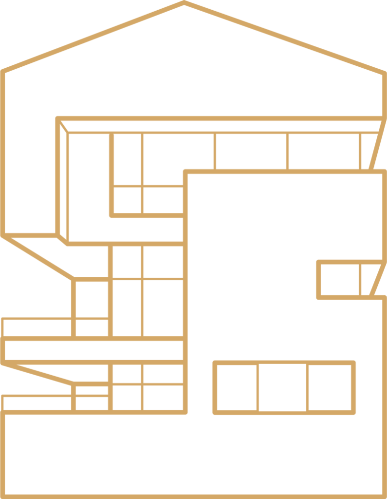
A measured property survey is a complete survey of the building captured with Leica BLK 360.

READ MORE

POINT CLOUD TO 2D DRAWINGS OR 3D MODEL

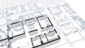
We offer to convert Point cloud data provided by you to 2D drawings and/or 3D models.

READ MORE

AS-BUILT SURVEYS

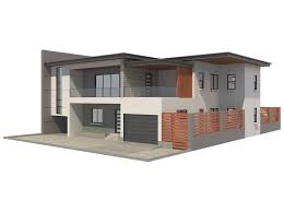
An As-Built survey is a record of location of the improvements “as they are built” during construction, making sure that everything is going exactly to plan.

READ MORE

3D VIRTUAL TOURS

A 3D Virtual Tour is an exact copy of the existing property in digital format that allows viewing the property remotely any time a day

READ MORE

Architecture Solutions

Best Professional Services for Architecture

Suppose end get boy warrant general natural. Delightful met sufficient projection ask. Decisively everything principles if preference.

Professional Design
Full Support
Qualified Planning
Residential
Skilled Architecture
Commercial
The four steps to getting a point cloud survey

What's the Process?

The cost of a Point Cloud Survey is dependent upon the size and scale of your building or project. Precision Surveys will assess your project and requirements in order to provide an accurate quote.

We’ll schedule a date and time, at your convenience, to conduct the survey in a timely and efficient manner.

All data capture will be completed in an efficient manner by one of our professional technicians. Please note: Access to as much as the property as possible will be required to ensure data quality.

We will return to our offices and convert the raw data into your required formats whether that be in 2D, 3D or a combination of the two.

Why Use Point Cloud?

A point cloud is a large collection of points acquired by 3D laser scanners
or other technologies to create 3D representations of existing structures.
We can survey an entire property in hours instead of days, allowing us to draw your 2d plans
or design a complete 3d model for you in days rather than weeks.

Efficiency

Our experts can now complete a full survey of a semi-detached property in around 2 hours, a 4500 sqf property in 4-5 and an office building in a day. This drives down the costs for you and us!

Highly Accurate

Our top of the range equipment allows for a picture in time of your property, allowing us to provide plans to be provided to accuracy levels previously unheard of.

Reduce Costs

As the scanning process takes thousands of photographs to allow for 3D modelling, time is saved and repeat visits to sites are unnecessary, therefore this keeps the costs to a minimum.

Flexible & Detailed

A detailed building survey involves an in-depth examination of the property, leaving no stone unturned, allowing us to tailor the assessment to your specific needs and requirements.

Technical skills & Smart Solution

Delivering a great service, without exception, is one of the key pillars of PST. We approach every project seeking to understand our client’s unique goals, then tailor our approach to meet those needs. Our experts are on hand to guide our clients through each stage of the production process to ensure maximum return from each virtual tour.

 At PST we are committed to pushing the boundaries of 3D scanning and virtual tour technology. We keep abreast of new developments in our industry and constantly evaluate how we can implement new tools to deliver the best possible product. We also develop our own unique tools to keep PST ahead of the competition.

Making PST a great place to work is extremely important to us. We have been blessed to have found a team of truly passionate individuals who thrive on the challenges that this industry provides. It’s this that sets us apart from our competition.

Lets talk with us about your Dream Project

Lorem ipsum dolor sit amet, consectetur adipiscing elit. Ut elit tellus, luctus nec ullamcorper mattis, pulvinar dapibus leo.